River subbasins more depleted than
official figures show
09 April 2024
Published online 31 March 2014
Iraq Spatial, a new interactive online development tool, has been launched to make vital information easily accessible to those tasked with improving food security and nutrition in the country.
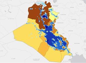
The tool delivers reliable and comprehensive data – categorized by indicators including climatic, socioeconomic, sectoral and biophysical – to help policymakers reach decisions based on scientific factors. The data will provide the basis for maps and charts to identify priority areas for work or interventions.
"Iraq Spatial pools data from different sources and allows the user to download it all. The more data people contribute in the future, the more useful Iraq Spatial becomes and the more it can contribute to sustainable development and better lives for Iraqi people," says Clemens Breisinger, senior research fellow at the International Food Policy Research Institute (IFPRI), which developed the conceptual framework for the project.
Nearly two million Iraqis are food-deprived and a further four million are vulnerable to food insecurity. The agricultural sector in Iraq has been severely curtailed by decades of war, international sanctions and environmental degradation. Policy reform remains a challenge due to considerable capacity constraints.
The head of the International Center for Agricultural Research in the Dry Area (ICARDA) Geoinformatics Unit, Chandrashekhar Biradar, says: "Iraq Spatial gives Iraq's decision-makers and research community the information they need to develop appropriate policy reforms and strategies that are capable of raising agricultural productivity and strengthening food security."
[Decision-makers] can customize the maps according to the specific questions they have.
"We have many researchers with different specializations whose work will benefit greatly from the mapping and remote sensing capabilities of Iraq Spatial," adds Muthana ElMuadhidi, director general of Iraq's State Board for Agriculture Research, who is eager to utilize the database for the board's work.
Breisinger pointed out the database's features. "Decision-makers have three broad levels of engagement at their fingertips: the most straightforward option is to browse the gallery of pre-fabricated maps and choose the one that matches their area of interest," he explains. "From there, [they] can customize the maps according to the specific questions they have."
The data can also illustrate which parts of the country are most in need of poverty-reduction measures and nutrition programmes; which areas have the largest potential for yield improvements; and which areas may need additional donor programmes.
As users are able to contribute data to the portal it will eventually become more comprehensive. ICARDA's Biradar explains that the integrity of the data added by users will be maintained by experts at ministries and relevant institutions who will be responsible for data collection and organization before it is added to the portal.
Iraq Spatial is the first country-specific portal to build from the related Arab Spatial, a region-wide database of geo-spatial information. It was developed through the USAID-funded Harmonized Support for Agriculture Development initiative and the joint efforts of the IFPRI and ICARDA, who compiled and applied the data.
doi:10.1038/nmiddleeast.2014.79
River subbasins more depleted than official figures show
09 April 2024
Arab countries perform poorly on climate action scorecard
24 March 2024
12 March 2024
Sign-up to receive our e-alert update every two weeks to keep up with everything new on the portal.
Sign up for e-alerts
Stay connected: